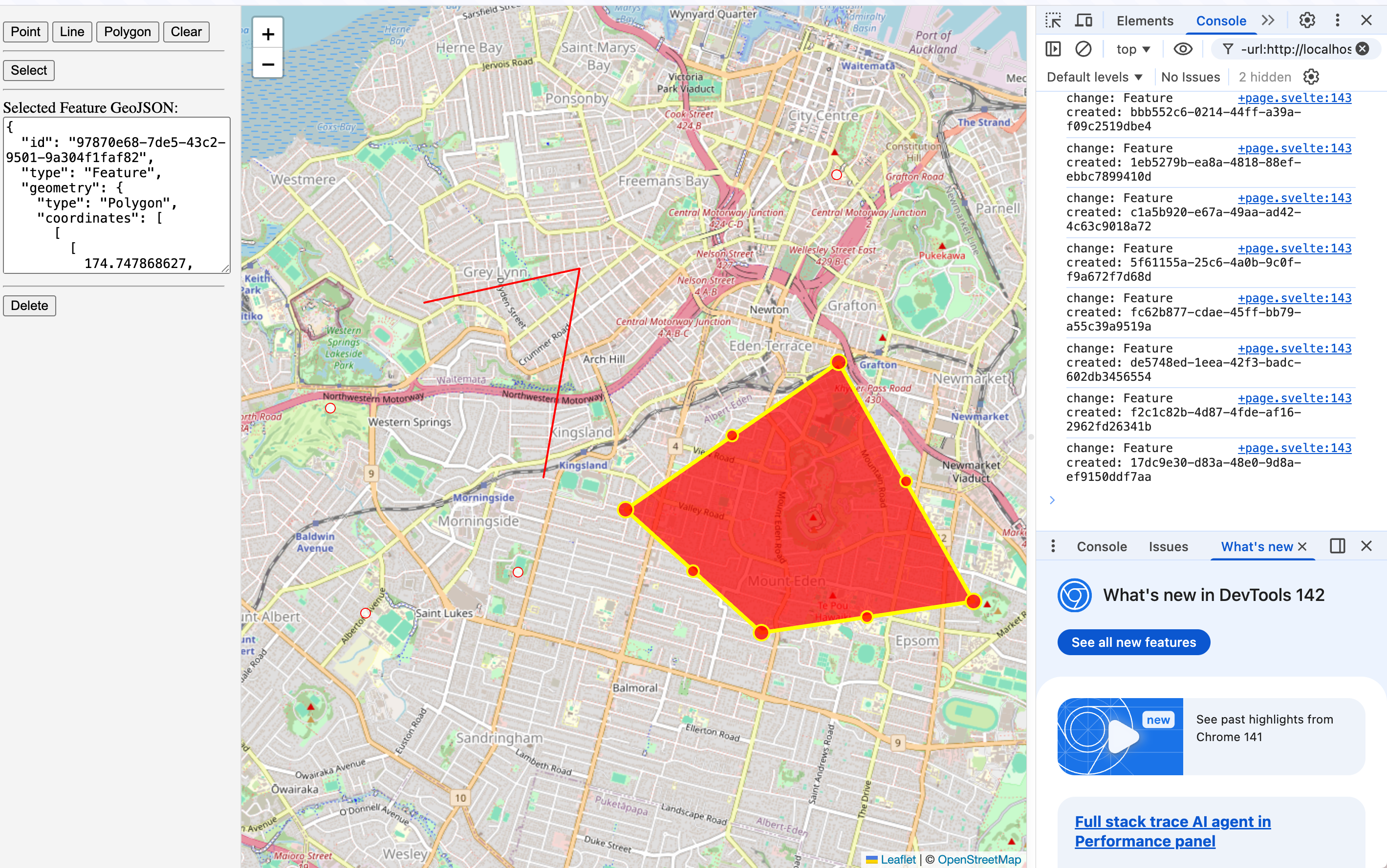
Replace maplibre with leaflet
You only need to change <script> tag section. The below is how you can change the code.
<script lang="ts">
- import {
- AttributionControl,
- GeolocateControl,
- GlobeControl,
- Map,
- NavigationControl,
- ScaleControl
- } from 'maplibre-gl';
import { onMount } from 'svelte';
- import 'maplibre-gl/dist/maplibre-gl.css';
import {
TerraDraw,
TerraDrawPointMode,
TerraDrawLineStringMode,
TerraDrawPolygonMode,
TerraDrawSelectMode,
TerraDrawExtend
} from 'terra-draw';
- import { TerraDrawMapLibreGLAdapter } from 'terra-draw-maplibre-gl-adapter';
// import leaflet and TerraDrawLeafletAdapter
+ import { TerraDrawLeafletAdapter } from 'terra-draw-leaflet-adapter';
+ import L from 'leaflet';
let mapContainer: HTMLDivElement | undefined = $state();
let map: Map | undefined = $state();
let draw: TerraDraw | undefined = $state();
let selectedFeature: string = $state('');
onMount(() => {
if (!mapContainer) return;
- map = new Map({
- container: mapContainer,
- style: {
- version: 8,
- name: 'OpnenStreetMap Raster',
- sources: {
- osm: {
- type: 'raster',
- tiles: ['https://tile.openstreetmap.jp/{z}/{x}/{y}.png'],
- tileSize: 256,
- maxzoom: 19,
- attribution:
- '<a href="https://www.openstreetmap.org/copyright" target="_blank">© OpenStreetMap contributors</a>'
- }
- },
- layers: [
- {
- id: 'osm',
- type: 'raster',
- source: 'osm'
- }
- ]
- },
- center: [174.7629, -36.8587],
- zoom: 11,
- hash: true,
- attributionControl: false
- });
- map.addControl(new NavigationControl(), 'top-right');
- map.addControl(new GlobeControl(), 'top-right');
- map.addControl(
- new GeolocateControl({
- positionOptions: { enableHighAccuracy: true },
- trackUserLocation: true
- }),
- 'top-right'
- );
- map.addControl(new ScaleControl({ maxWidth: 80, unit: 'metric' }), 'bottom-left');
- map.addControl(new AttributionControl({ compact: true }), 'bottom-right');
// create Leaflet map object
+ map = L.map(mapContainer).setView([-36.8587, 174.7629], 11);
+
+ L.tileLayer('https://tile.openstreetmap.org/{z}/{x}/{y}.png', {
+ maxZoom: 19,
+ attribution: '© <a href="http://www.openstreetmap.org/copyright">OpenStreetMap</a>'
+ }).addTo(map);
draw = new TerraDraw({
// Use TerraDrawLeafletAdapter instead of TerraDrawMapLibreGLAdapter
+ adapter: new TerraDrawLeafletAdapter({ map, lib: L }),
- // Using the MapLibre Adapter
- adapter: new TerraDrawMapLibreGLAdapter({ map }),
// Add the Point, LineString, Polygon and Select Mode
modes: [
new TerraDrawPointMode({
styles: {
pointColor: '#FFFFFF',
pointWidth: 5,
pointOutlineColor: '#FF0000',
pointOutlineWidth: 1
}
}),
new TerraDrawLineStringMode({
styles: {
lineStringColor: '#FF0000',
lineStringWidth: 2,
closingPointColor: '#FFFFFF',
closingPointWidth: 3,
closingPointOutlineColor: '#FF0000',
closingPointOutlineWidth: 1
}
}),
new TerraDrawPolygonMode({
styles: {
fillColor: '#FFFFFF',
fillOpacity: 0.7,
outlineColor: '#FF0000',
outlineWidth: 2,
closingPointColor: '#FFFFFF',
closingPointWidth: 3,
closingPointOutlineColor: '#FF0000',
closingPointOutlineWidth: 1
}
}),
// Add Select mode with feature and coordinate editing enabled
new TerraDrawSelectMode({
styles: {
// Point colour
selectedPointColor: '#FF0000',
selectedPointWidth: 7,
selectedPointOutlineColor: '#FFFF00',
selectedPointOutlineWidth: 2,
// LineString colour
selectedLineStringColor: '#FFFF00',
selectedLineStringWidth: 4,
// Polygon colour
selectedPolygonColor: '#FF0000',
selectedPolygonFillOpacity: 0.7,
selectedPolygonOutlineColor: '#FFFF00',
selectedPolygonOutlineWidth: 4,
// Selection point colour
selectionPointColor: '#FF0000',
selectionPointWidth: 8,
selectionPointOutlineColor: '#FFFF00',
selectionPointOutlineWidth: 2,
// Midpoint colour
midPointColor: '#FF0000',
midPointWidth: 6,
midPointOutlineColor: '#FFFF00',
midPointOutlineWidth: 2
},
flags: {
point: {
feature: {
draggable: true
}
},
linestring: {
feature: {
draggable: true,
rotateable: true,
coordinates: {
midpoints: true,
draggable: true,
deletable: true
}
}
},
polygon: {
feature: {
draggable: true,
rotateable: true,
coordinates: {
midpoints: true,
draggable: true,
deletable: true
}
}
}
}
})
]
});
// leaflet does not need `load` event.
- map.once('load', () => {
// Start drawing
draw?.start();
draw?.on('change', (ids, type) => {
if (!draw) return;
if (type
// After creating a feature
for (const id of ids) {
// Do something
console.log(`change: Feature created: ${id}`);
}
} else if (type
//After updating a feature
for (const id of ids) {
console.log(`change: Feature updated: ${id}`);
}
} else if (type
//After deleting a feature
for (const id of ids) {
console.log(`change: Feature deleted: ${id}`);
}
} else if (type
//After styling is changed
for (const id of ids) {
console.log(`change: Feature styling updated: ${id}`);
}
}
});
draw?.on(
'finish',
(id: TerraDrawExtend.FeatureId, context: { action: string; mode: string }) => {
if (context.action
// Do something for draw finish event for a feature
console.log(`finish: Feature drawn: ${id} in mode: ${context.mode}`);
} else if (context.action
// Do something for a drag finish event for a feature
console.log(`finish: Feature dragged: ${id} in mode: ${context.mode}`);
} else if (context.action
// Do something for a drag finish event for a coordinate
console.log(`finish: Coordinate dragged in feature: ${id} in mode: ${context.mode}`);
} else if (context.action
// Do something for a drag finish event for resizing a feature
console.log(`finish: Coordinate resized in feature: ${id} in mode: ${context.mode}`);
}
}
);
draw?.on('select', (id: TerraDrawExtend.FeatureId) => {
console.log(`selected: ${id}`);
const feature = draw?.getSnapshotFeature(id);
selectedFeature = feature ? JSON.stringify(feature, null, 2) : '';
});
draw?.on('deselect', () => {
console.log(`deselected`);
selectedFeature = '';
});
// Add a default point feature at Auckland University of Technology
draw?.addFeatures([
{
id: '39d86739-6012-40ae-bb8c-3cb0f0694b92',
type: 'Feature',
geometry: {
type: 'Point',
coordinates: [174.766430366, -36.85309055]
},
properties: {
mode: 'point'
}
}
]);
- });
});
const handleModeClick = (mode: string) => {
draw?.setMode(mode);
};
const handleClearClick = () => {
draw?.clear();
};
const handleDeleteClick = () => {
const targetFeature = selectedFeature ? JSON.parse(selectedFeature) : null;
if (targetFeature && targetFeature.id) {
draw?.removeFeatures([targetFeature.id]);
}
};
</script>
You can see the change is really minumum and everything can work without changing anything on Terra Draw side.